Full image
, specimen")
Licensed under CC-BY 4.0 (see recommended citation in "Full record" following "How to cite" link)
Do you want to join the team of "Distribution Atlas of the Russian Flora"? Upload your photos of plants in wild with exact location on iNaturalist to contribute our new project "Флора России | Flora of Russia".
- Barcode
- MW0027580
- Collection name
- Puccinellia angustata
- Accepted name
- Puccinellia angustata (R.Br.) E.L.Rand & Redfield
- Family
- Poaceae
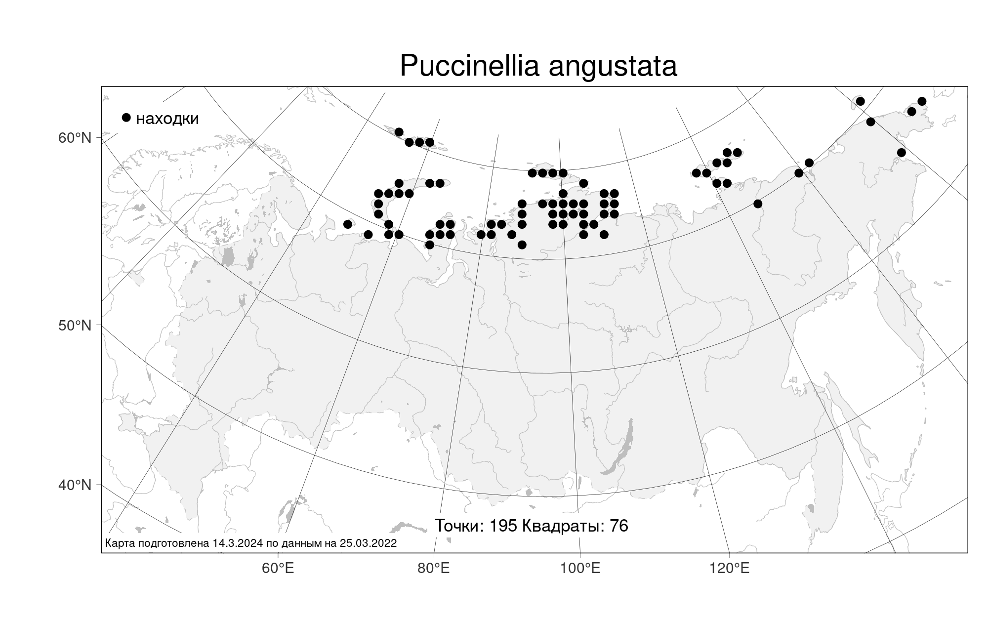
- Geography
- Siberia, Central Siberia (S3) (Russia)
- Georeference
- 74.6638, 103.2101
- Label data
-
Puccinellia angustata (R. Br.) Rand et Redf.
Центральный Таймыр, северный берег оз.Таймыр в районе устья р. Оленьей. Глинисто-песчаные осыпи на ярах за р. Декадюкара-Тари. Elev. 20 m a.s.l.
31.07.2000. Coll. Е.Б. Поспелова, № 00-280
Det. Н.Н. Цвелев
Label input date 8.10.2017
All specimens of the species
Materials of the "Atlas of the Russian flora" (detail)
All pictures of the species in wild (iNaturalist.org)
All pictures of the species in wild (plantarium.ru)
Report a mistake
How to cite (resource)
Seregin A. P. (Ed.). 2026. Moscow Digital Herbarium: Electronic resource. – Moscow State University, Moscow. – Available at: https://plant.depo.msu.ru/ (accessed 22.06.2026)
See recommended citation of the individual specimen in "Full record" following "How to cite" link