Full image
, specimen")
Licensed under CC-BY 4.0 (see recommended citation in "Full record" following "How to cite" link)
Do you want to join the team of "Distribution Atlas of the Russian Flora"? Upload your photos of plants in wild with exact location on iNaturalist to contribute our new project "Флора России | Flora of Russia".
- Barcode
- MW0075203
- Collection name
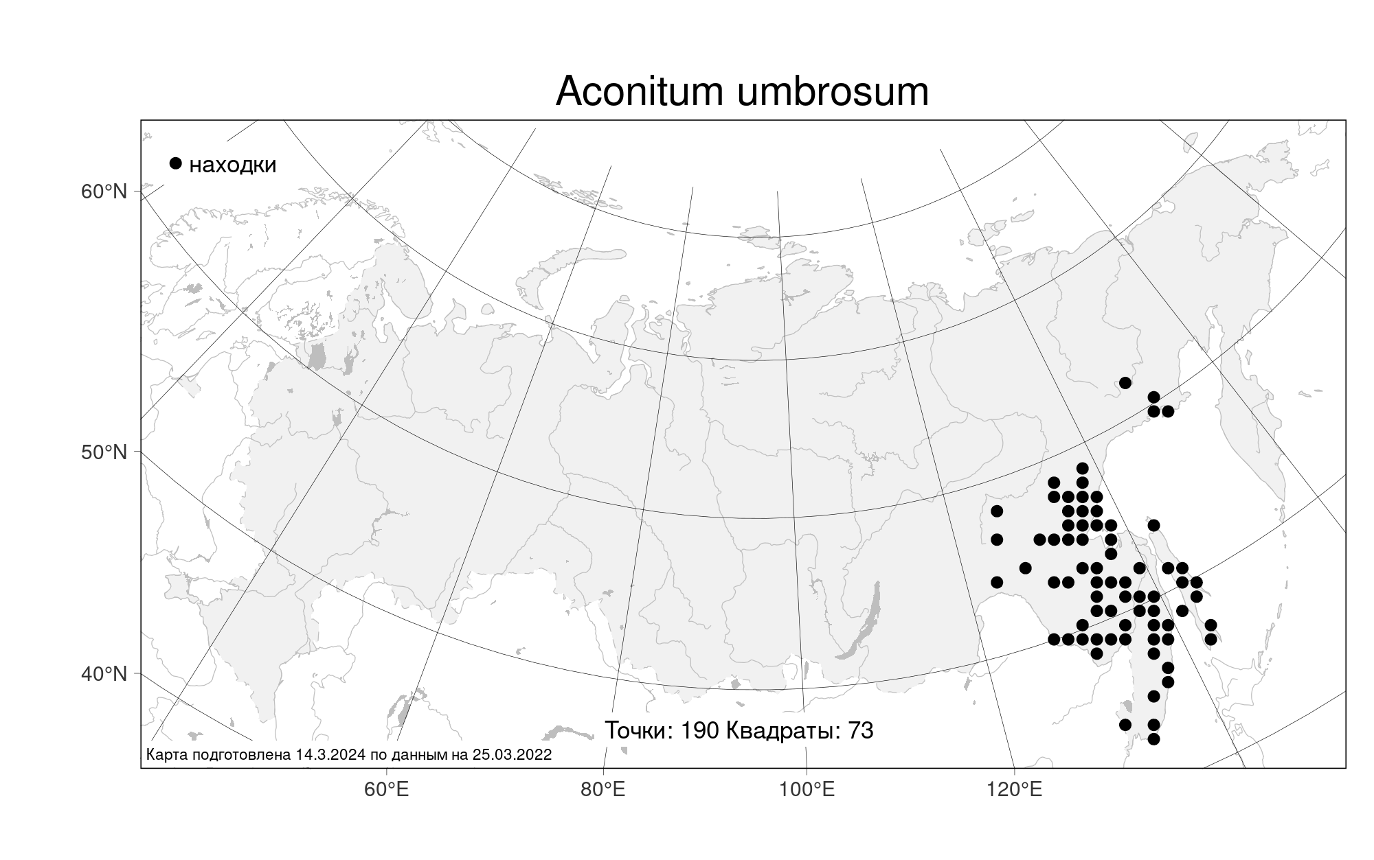
- Aconitum umbrosum
- Accepted name
- Aconitum umbrosum (Korsh.) Kom.
- Family
- Ranunculaceae
- Geography
- Siberia, Russian Far East (S6) (Russia)
- Georeference
- 52.0667, 134.875
- Label data
-
Хабаровский край, Верхне-Буреинский район, Буреинский заповедник, бассейн верхнего течения р. Лев. Бурея, окрестности высокогорного озера в верхнем течении ее левого притока в 3 км к З от выс. 2041 м (хребет Дуссе-Алинь), фрагмент каменноберезника в подгольцовом поясе, на поляне, часто. Elev. 1500 m a.s.l.
14.08.1989. Coll. Кожевников А. Е.
Det. Луферов А., 3.08.1993
Label input date 28.03.2019
All specimens of the species
Materials of the "Atlas of the Russian flora" (detail)
All pictures of the species in wild (iNaturalist.org)
All pictures of the species in wild (plantarium.ru)
Report a mistake
How to cite
Seregin A. P. (Ed.). 2024. Moscow Digital Herbarium: Electronic resource. – Moscow State University, Moscow. – Available at: https://plant.depo.msu.ru/ (accessed 27.12.2024)
See recommended citation of the individual specimen in "Full record" following "How to cite" link