Full image
, specimen")
Licensed under CC-BY 4.0 (see recommended citation in "Full record" following "How to cite" link)
Do you want to join the team of "Distribution Atlas of the Russian Flora"? Upload your photos of plants in wild with exact location on iNaturalist to contribute our new project "Флора России | Flora of Russia".
- Barcode
- MW0075687 (related GBIF-records)
- Collection name
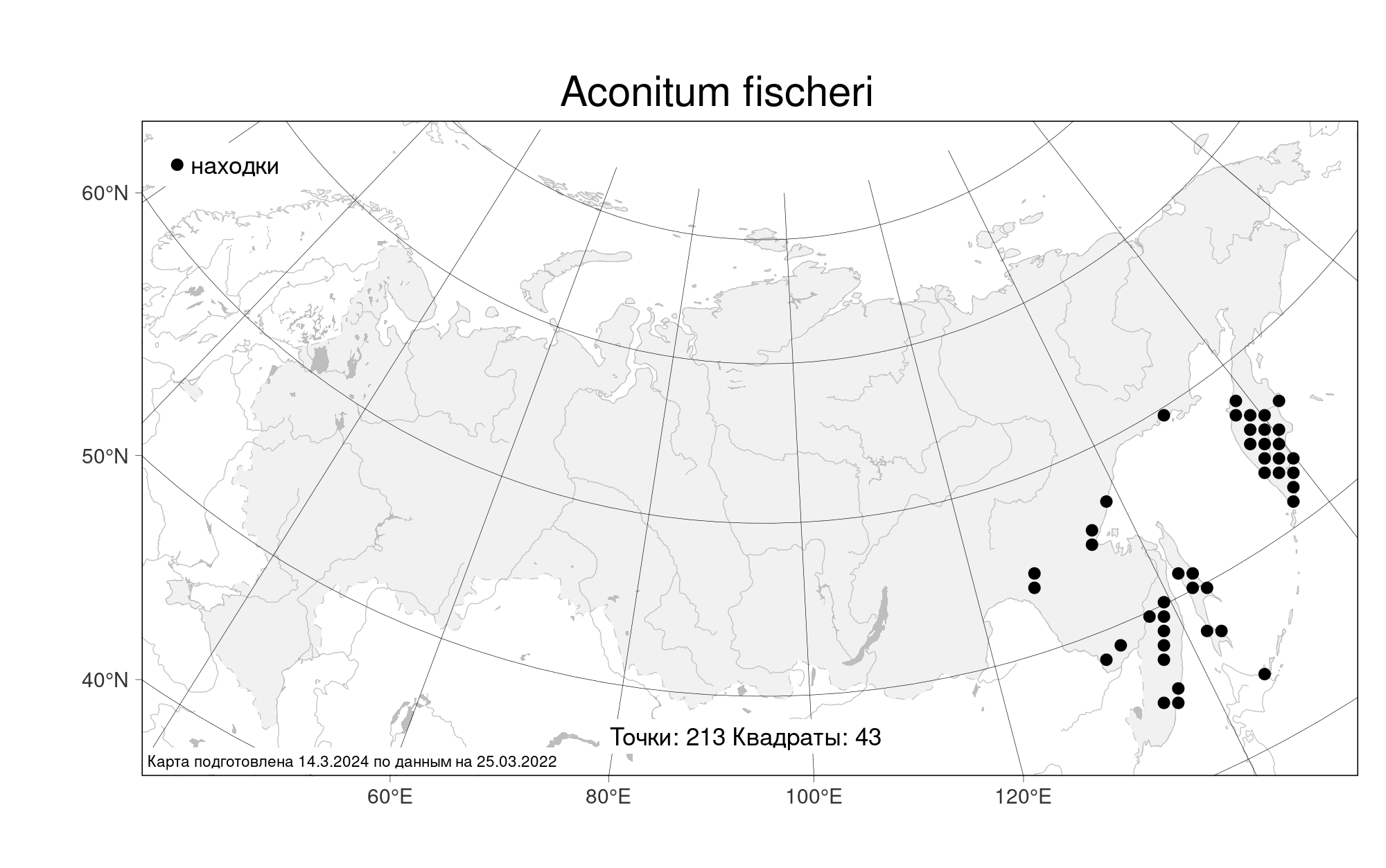
- Aconitum fischeri
- Accepted name
- Aconitum fischeri Rchb.
- Family
- Ranunculaceae
- Geography
- Siberia, Russian Far East (S6) (Russia)
- Georeference
- 48.893, 138.0582
- Label data
-
PLANTAE VASCULARES ORIENTIS EXTREMI ROSSICI (VLA) FLORA EXSICCATA
Aconitum fischeri Rchenb.
Khabarovskiy territory, Nanayskiy district, mountain Tardoky-Yany (2077 m) herb meadow on Picea ajanensis timberline in the source of Bomboly stream, along of stream, frequent.. Elev. 2077 m a.s.l.
29.07.1983. Coll. S. Kharkevich, T. Buch, I. Vyshin, № 69b
Luferov, 1995, Pl. Vasc., 7:63.
Label input date 18.04.2024
All specimens of the species
Materials of the "Atlas of the Russian flora" (detail)
All pictures of the species in wild (iNaturalist.org)
All pictures of the species in wild (plantarium.ru)
Report a mistake
How to cite (resource)
Seregin A. P. (Ed.). 2026. Moscow Digital Herbarium: Electronic resource. – Moscow State University, Moscow. – Available at: https://plant.depo.msu.ru/ (accessed 11.03.2026)
See recommended citation of the individual specimen in "Full record" following "How to cite" link