Full image
, specimen")
Licensed under CC-BY 4.0 (see recommended citation in "Full record" following "How to cite" link)
Do you want to join the team of "Distribution Atlas of the Russian Flora"? Upload your photos of plants in wild with exact location on iNaturalist to contribute our new project "Флора России | Flora of Russia".
- Barcode
- MW0200039
- Collection name
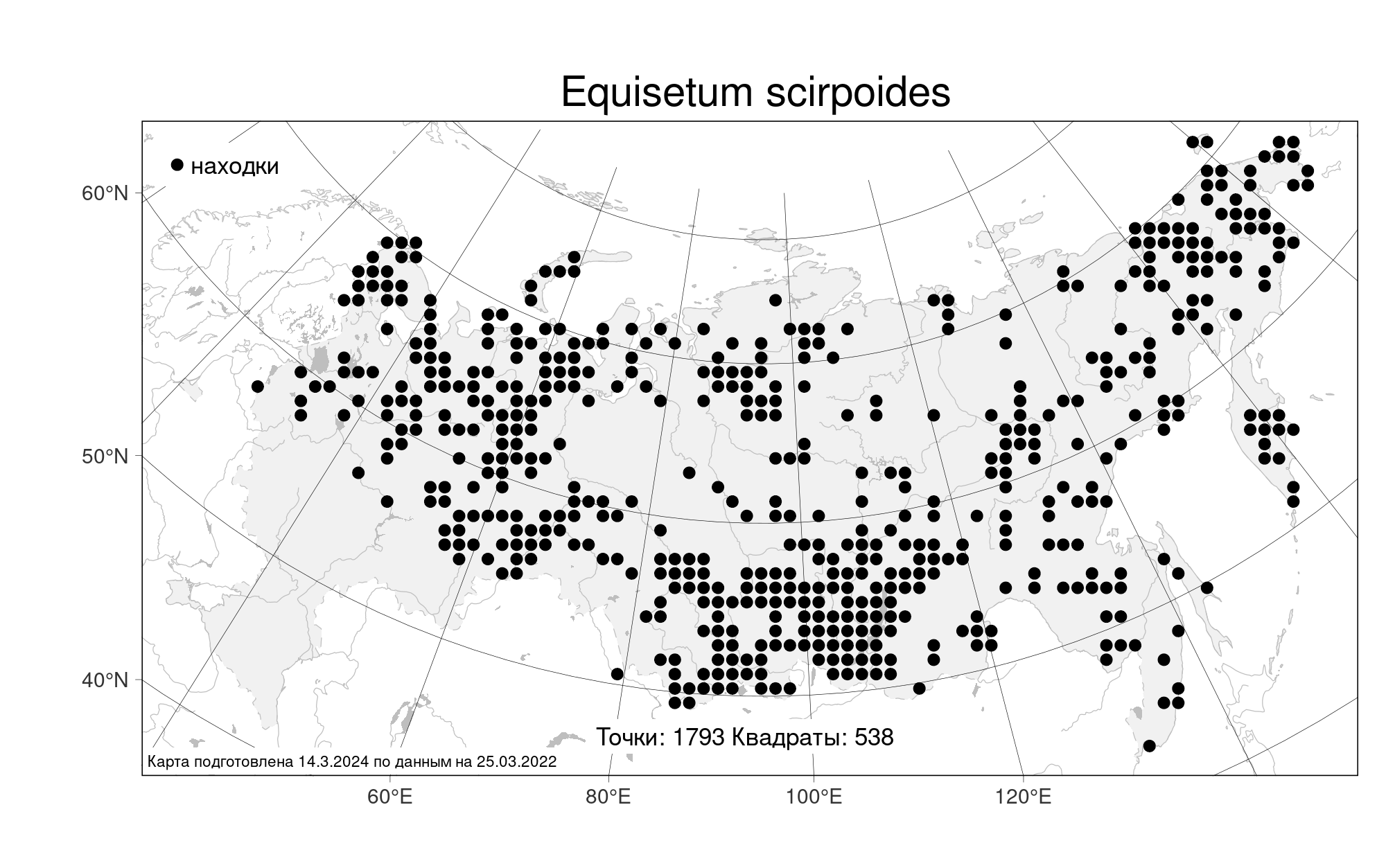
- Equisetum scirpoides
- Accepted name
- Equisetum scirpoides Michx.
- Family
- Equisetaceae
- Geography
- Eastern Europe, Northern region (E1) (Russia)
- Georeference
- 67.1295, 41.2236
- Label data
-
Equisetum scirpoides Michx.
Мурманская область, Ловозерский район, восточное побережье Кольского полуострова, долина реки Русинга, исток ручья Правый Шупаш, скальная стенка северной экспозиции 90° крутизной зарослями с Viola biflora, Ranunculus subborealis и Veratrum lobelianum на левом берегу ручья; [точка сбора по дневнику]: 107/15 (т. 423) == Lovozerskij Distr., eastern coast of Kola Peninsula, Rusinga River Valley, rise of Pravyj Shupash Brook, scarp rock noth exp. wall with Viola biflora, Ranunculus subborealis and Veratrum lobelianum on the left brookbank. Elev. 110 m a.s.l.
23.07.2015. Coll. Кожин М.Н.==Kozhin M.N., Копеина Е.И.==Kopeina E.I., № M-3300
Det. Кожин М.Н.
Label input date 13.01.2020
All specimens of the species
Materials of the "Atlas of the Russian flora" (detail)
All pictures of the species in wild (iNaturalist.org)
All pictures of the species in wild (plantarium.ru)
Report a mistake
How to cite
Seregin A. P. (Ed.). 2024. Moscow Digital Herbarium: Electronic resource. – Moscow State University, Moscow. – Available at: https://plant.depo.msu.ru/ (accessed 09.05.2024)
See recommended citation of the individual specimen in "Full record" following "How to cite" link