Full image
, specimen")
Licensed under CC-BY 4.0 (see recommended citation in "Full record" following "How to cite" link)
Do you want to join the team of "Distribution Atlas of the Russian Flora"? Upload your photos of plants in wild with exact location on iNaturalist to contribute our new project "Флора России | Flora of Russia".
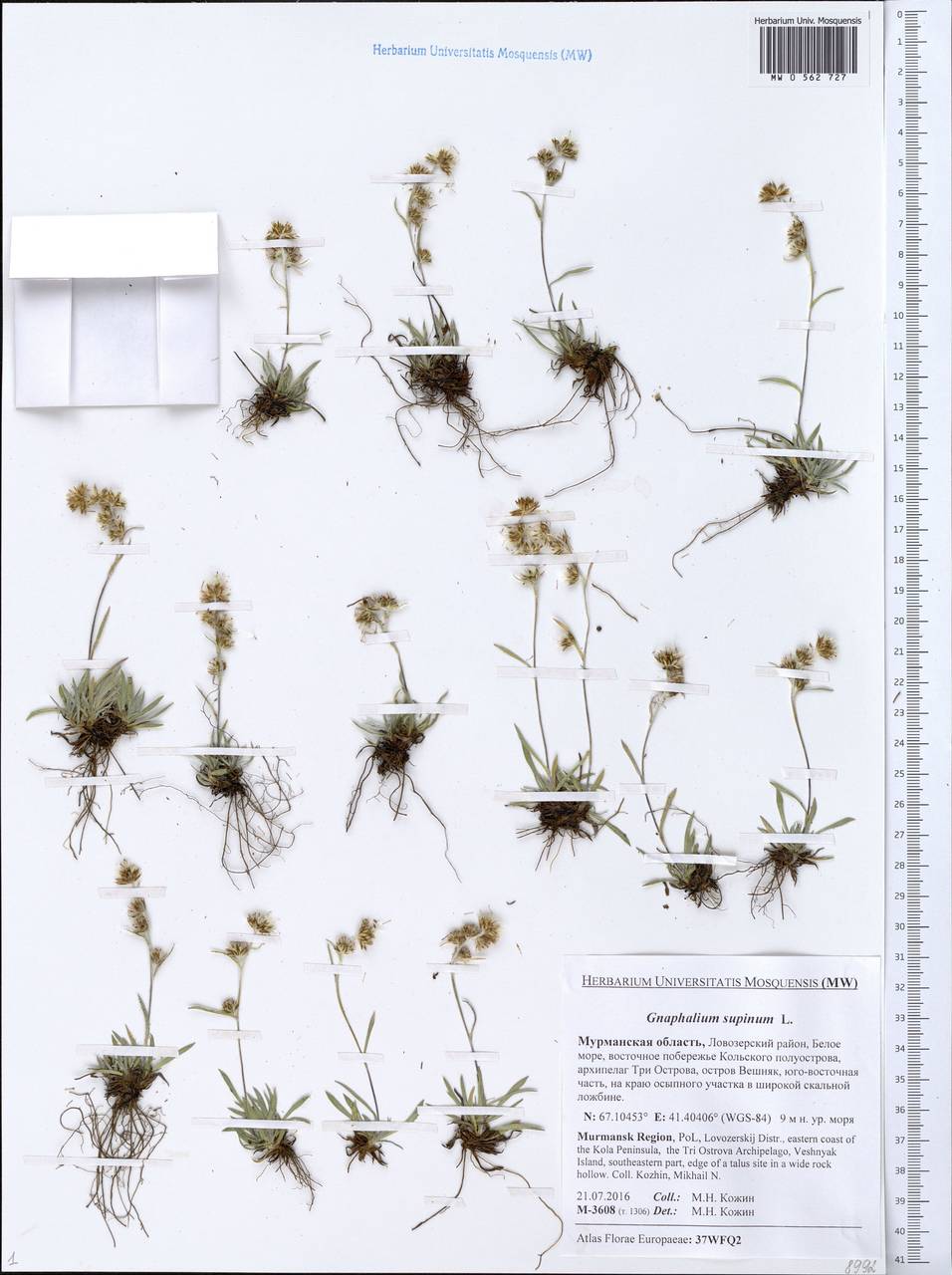
- Barcode
- MW0562727
- Collection name
- Omalotheca supina
- Accepted name
- Omalotheca supina (L.) DC.
- Family
- Asteraceae
- Geography
- Eastern Europe, Northern region (E1) (Russia)
- Georeference
- 67.1045, 41.4041
- Label data
-
Gnaphalium supinum L.
Мурманская область, Ловозерский район, восточное побережье Кольского полуострова, архипелаг Три Острова, остров Вешняк, юго-восточная часть, на краю осыпного участка в широкой скальной ложбине; [точка сбора по дневнику]: т. 1306 == Lovozerskij Distr., eastern coast of the Kola Peninsula, the Tri Ostrova Archipelago, Veshnyak Island, southeastern part, edge of a talus site in a wide rock hollow. Elev. 9 m a.s.l.
21.07.2016. Coll. Кожин М.Н.==Kozhin M.N., № M-3608
Det. Кожин М.Н.
Label input date 13.01.2020
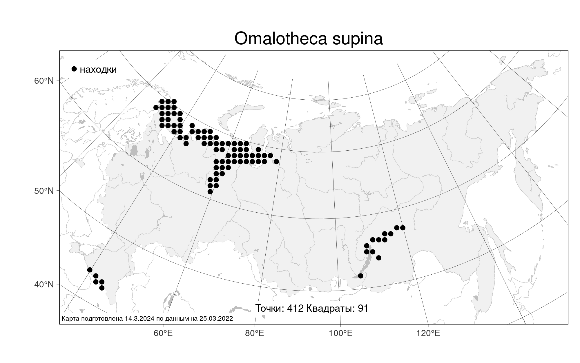
All specimens of the species
Materials of the "Atlas of the Russian flora" (detail)
All pictures of the species in wild (iNaturalist.org)
All pictures of the species in wild (plantarium.ru)
Report a mistake
How to cite
Seregin A. P. (Ed.). 2024. Moscow Digital Herbarium: Electronic resource. – Moscow State University, Moscow. – Available at: https://plant.depo.msu.ru/ (accessed 02.05.2024)
See recommended citation of the individual specimen in "Full record" following "How to cite" link