Full image
, specimen")
Licensed under CC-BY 4.0 (see recommended citation in "Full record" following "How to cite" link)
Do you want to join the team of "Distribution Atlas of the Russian Flora"? Upload your photos of plants in wild with exact location on iNaturalist to contribute our new project "Флора России | Flora of Russia".
- Barcode
- MW0562847
- Collection name
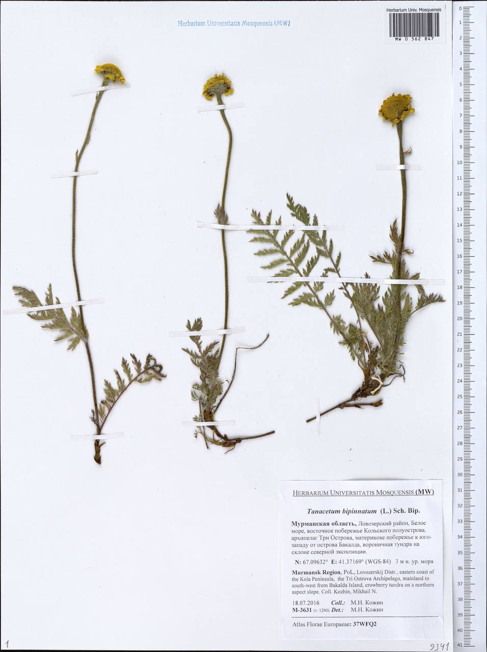
- Tanacetum bipinnatum
- Accepted name
- Tanacetum bipinnatum (L.) Sch. Bip.
- Family
- Asteraceae
- Geography
- Eastern Europe, Northern region (E1) (Russia)
- Georeference
- 67.0963, 41.3717
- Label data
-
Tanacetum bipinnatum (L.) Sch. Bip.
Мурманская область, Ловозерский район, восточное побережье Кольского полуострова, архипелаг Три Острова, материкове побережье к юго-западу от острова Бакалда, вороничная тундра на склоне северной экспозиции; [точка сбора по дневнику]: т. 1290 == Lovozerskij Distr., eastern coast of the Kola Peninsula, the Tri Ostrova Archipelago, mainland to south-west from Bakalda Island, crowberry tundra on a northern aspect slope. Elev. 3 m a.s.l.
18.07.2016. Coll. Кожин М.Н.==Kozhin M.N., № M-3631
Det. Кожин М.Н.
Label input date 13.01.2020
All specimens of the species
Materials of the "Atlas of the Russian flora" (detail)

All pictures of the species in wild (iNaturalist.org)
All pictures of the species in wild (plantarium.ru)
Report a mistake
How to cite
Seregin A. P. (Ed.). 2026. Moscow Digital Herbarium: Electronic resource. – Moscow State University, Moscow. – Available at: https://plant.depo.msu.ru/ (accessed 17.01.2026)
See recommended citation of the individual specimen in "Full record" following "How to cite" link