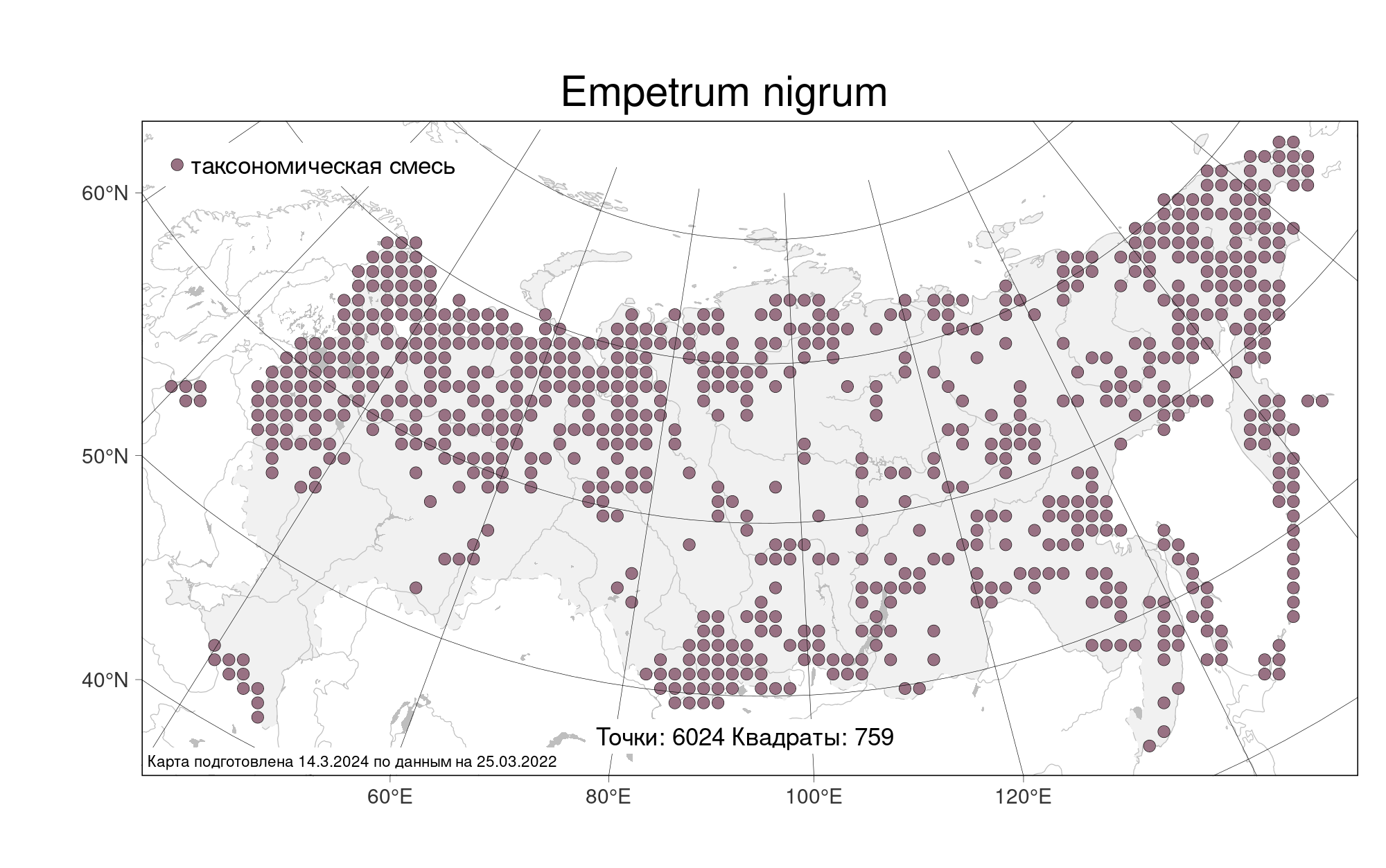
Full image
, specimen")
Licensed under CC-BY 4.0 (see recommended citation in "Full record" following "How to cite" link)
Do you want to join the team of "Distribution Atlas of the Russian Flora"? Upload your photos of plants in wild with exact location on iNaturalist to contribute our new project "Флора России | Flora of Russia".
- Barcode
- MW0111852
- Collection name
- Empetrum nigrum
- Accepted name
- Empetrum nigrum L.
- Family
- Ericaceae
- Geography
- Siberia, Russian Far East (S6) (Russia)
- Georeference
- 51.5, 134.4167
- Label data
-
Хабаровский край, Верхнебуреинский район, хребет Дуссе-Алинь, Буреинский заповедник, водораздел бассейнов рек Ян-Макит, Иппатинка (басс. Левой Буреи), Серегекта (басс. Буреи) и Мерек (басс. Амгуни). Переход от выположенной части вершины гольца с отметкой 1923,3 к крутому юго-вост. склону; кустарничково-лишайниковая горная тундра. Elev. 1920 m a.s.l.
3.08.1989. Coll. Петелин Д. А., № 89-59
Label input date 28.03.2019
All specimens of the species
Materials of the "Atlas of the Russian flora" (detail)
All pictures of the species in wild (iNaturalist.org)
All pictures of the species in wild (plantarium.ru)
Report a mistake
How to cite (resource)
Seregin A. P. (Ed.). 2026. Moscow Digital Herbarium: Electronic resource. – Moscow State University, Moscow. – Available at: https://plant.depo.msu.ru/ (accessed 16.05.2026)
See recommended citation of the individual specimen in "Full record" following "How to cite" link